Drone permissions in Western Australia
Who actually controls where you can fly, launch and land, and what a production needs to arrange before a shoot day in WA.
Perth-area land manager directory
Who needs what, council by council
There is no consolidated register of drone positions in WA, and most land managers publish theirs inconsistently: sometimes in a local law, sometimes inside a filming permit page, often nowhere at all. This directory records what each council and land-managing authority states, with the date it was last checked.
City of South Perth no permit, no fee Checked Jul 2026
Notification to Bookings Office preferred. No exclusive use of parks or reserves.
Town of East Fremantle no permit (CASA only) Checked Aug 2026
Town approval is not required to fly. CASA rules apply in full. Exclusive rights to parks and reserves are not granted for drone flying.
City of Perth permit required Checked Aug 2026
Confirmed by the Obstruction Permits team. Any launch or landing on City-managed land needs a Filming and Drone permit, lodged as an Obstruction Permit. Requires the pilot’s RePL, a marked 30 m exclusion zone with signage, $10m public liability, and a pedestrian/traffic management plan where footpaths or road reserves are affected. Min. 5 full business days; a $150 late fee may apply for expedited assessment of a basic drone application with no road closures.
City of Fremantle permit required Checked Aug 2026
Confirmed by the City’s film contact. Commercial = crossing boundaries, filming in the street, or any promotional use; a permit is then required. Fee $150–$2,000 by impact; one drone and one operator following CASA rules sits at $150. $10m public liability required. Min. 1 week’s notice; one permit can span multiple days and dates can be moved for weather up to three times. Fees may be waived for students, or footage promoting Fremantle interstate/overseas. No flying over City events. Ports, Prison and Fishing Boat Harbour land need their own permission.
Fremantle Ports written approval required Checked Oct 2026
Not a council, and not covered by the City of Fremantle’s permit. Taken from Fremantle Ports’ published filming and drone pages, not a written reply. The port controls the Inner Harbour (North Quay, including Rous Head and North Mole, and Victoria Quay), Kwinana Port and the port waters. Any commercial filming, and any drone flight whether commercial or private, inside the port boundary needs written approval from the port’s Corporate and Community Relations team: a drone application naming the production, how the footage will be used and the nominated licensed pilots, with a signed and witnessed indemnity, proof of at least $10m public liability and a map of the area, lodged complete at least 10 working days ahead; risk, safety and traffic management plans may also be asked for. Fly only over the port and the requested area, never over public areas or other private land without permission, and not where it distracts or interferes with any port operation. Operational and security areas also need clearance from the shipping agent or stevedore, and anyone without an MSIC and port access must be escorted. Port operations take priority, so dates can change at short notice, approval can be cancelled or limited, and charges may apply to keep the activity cost neutral to the port.
City of Stirling no permit (CASA only) Checked Jul 2026
No drone permit issued; fly per CASA rules. Two designated drone areas: Hertha North Reserve and Yokine Regional Open Space West. Not over beaches, busy parks or ovals in use. Commercial filming needs a permit.
City of Vincent permit required Checked Aug 2026
Confirmed by the City’s Ranger Support Officer. Permission required to take off or land where the activity is commercial filming. Filming permit via Ranger Permits: $110 per location, min. 3 business days, and the City wants licences plus a flight plan/JSA with the application. Assessed case by case, and applying does not guarantee approval.
Town of Cottesloe permit required Checked Aug 2026
Confirmed by the Town’s Acting Event Coordinator. Permission is required to take off or land on Town-managed land, and licence and insurance documentation must be supplied with dates and times. Recreational flying is not permitted anywhere in the Town. All drone activity must be registered through the Town’s SpacetoCo booking platform. Commercial film and photo bookings at the Civic Centre and surrounds run from $220/hr (capped at $1,540/day) plus a mandatory $258 permit application fee; the non-commercial listing starts at $111/hr. The council@ address was discontinued in 2026; enquiries now go to Events@cottesloe.wa.gov.au. Ring the Town for exclusions, designated areas and event or seasonal restrictions.
City of Joondalup no permit (CASA only) Checked Aug 2026
Confirmed by the City’s Community Safety team. Launching and retrieval permitted in parks and reserves provided it causes no nuisance, and the rule does not change for commercial work: no permit, no fee. Not permitted in National Park areas. The same applies on the foreshore, and the City advises that flying out over the ocean should be discussed with the Department of Fisheries. Letting Community Safety know when and where you intend to fly is suggested.
City of Cockburn no permit (CASA only) Checked Aug 2026
City approval is not required. Publishes a dedicated drone page. Note Jandakot Airport: controlled airspace covers much of the district.
City of Swan permit required Checked Aug 2026
Confirmed from the City’s Film Friendly Guidelines (Apr 2026). Filming and photography on City land goes through a film request, handled by a dedicated Film Liaison Officer; CASA drone rules are named in the compliance list, so aerial work sits inside the same process. Min. 5 working days, or 15 for road closures and complex shoots. Requires $20m public liability (double what Perth and Fremantle ask), plus a risk management plan, a traffic/pedestrian plan where relevant, and notification of affected businesses and residents at least 5 business days ahead. In Aug 2026 the City’s Media and PR Officer confirmed there are no drone-specific blanket exclusions or seasonal bans beyond CASA rules, and for a single operator in and out inside an hour asked operators to act responsibly and go ahead, while noting policy here is a grey area. Treat that as informal guidance: the film request process remains the City’s formal position.
City of Rockingham permit required Checked Aug 2026
Confirmed by the City’s Senior Activity Approvals Officer. All commercial drone use requires City approval to take off or land on public land or City property, regardless of drone size or type, and permits will not be issued to unlicensed operators even for a sub-2 kg aircraft. Applications go through the Filming Permit process. The published form asks for up to 21 business days and lists $200 for the first day, $100 per subsequent day, with public liability of at least $10m. The form is dated 2018, so confirm current figures. Applications need RePL licences, the ReOC, a certificate of currency, a risk assessment, CASA area approval where applicable, and an operations plan. A 30 m exclusion zone must be marked out with signage, bollards and tape. Fees are waived for news and current affairs, and for community-benefit, charity or Rockingham heritage projects.
Kings Park (BGPA) permit required Checked Aug 2026
Confirmed by BGPA bookings. Hobby flying is prohibited in Kings Park and Bold Park. Professional work only, in two areas: the Boardwalk Vista (1.4 km fire break, May Drive Parkland to the Botanic Gardens) between 9am–6pm; and the Fraser Avenue end, treated as populated parkland, so permits are strictly dawn + 30 minutes only. Filming the State War Memorial precinct needs written permission from RSLWA and BGPA. Commercial filming $200/hr; community and charity $80/hr; news media free. Moonlight Cinema (Dec–Mar) closes part of the Boardwalk Vista late in the day.
Bold Park (BGPA) permit required Checked Aug 2026
Not a council; also Botanic Gardens and Parks Authority. Hobby flying prohibited, same as Kings Park. Commercial work goes through the same filming and photography application.
Rottnest Island (RIA) permit required Checked Oct 2026
Not a council. Recreational flying prohibited. Commercial drone use only via a filming permit: drone declaration, licence documents and a risk management plan due min. 30 days before the shoot. Fees from 1 July 2026: $241 application, $171 drone application, and $606 for the first day of motion filming, $404 each extra day.
Perth Zoo prohibited Checked Oct 2026
Not a council. No drone operations within or above Zoo grounds under any circumstances, to protect the animals, staff and visitors, so there is no approval process, fee or lead time to ask about. The Zoo sits on Labouchere Road beside the South Perth foreshore, so a foreshore or river flight that overflies it is out as well. Confirmed by the Zoo by email.
Metropolitan Cemeteries Board approval required Checked Oct 2026
Not a council. Runs Karrakatta, Fremantle, Pinnaroo, Guildford, Midland and Rockingham cemeteries. Any drone flight over a cemetery needs the Board’s prior approval, filming or not, because flying can disrupt funerals and visitors; commercial drone filming can be approved. No fee for a standard approval, though fees may apply to larger productions that need staff supervision. Send a certificate of currency (at least $10m public liability) and the Board’s Permission to Film in a Cemetery form at least 3 business days ahead, for CEO approval. Funerals take precedence, so an approved shoot can be moved or rescheduled; no filming of mourners or visitors without consent, and no identifiable graves, plaques or inscriptions without the family’s permission. Confirmed by the Board’s Community Education and Liaison manager by email.
What we've confirmed
Six things worth knowing before you plan a Perth aerial
Written replies from each land manager, July to October 2026 (Fremantle Ports from its published pages).
Kings Park is far more restricted than it looks
Only two areas are open to professional work at all, and the one with the city and river view (the Fraser Avenue end) is treated as populated parkland, so permits run from dawn plus 30 minutes only. If the brief is a Perth skyline aerial from Kings Park, that is a sunrise call time.
Public liability cover is not one number
Perth, Fremantle, Rockingham, Fremantle Ports and the Cemeteries Board ask for $10m. The City of Swan asks for $20m. A certificate that satisfies one council can fall short at the next, so check the figure before quoting rather than on the day.
Fees vary more than you'd expect
Joondalup, Cockburn and the Cemeteries Board charge nothing. Vincent is $110 per location. Fremantle runs $150–$2,000 by impact. Kings Park charges $200 an hour. Rockingham charges $200 for the first day, $100 for each one after. Rottnest stacks a $241 application, a $171 drone application and $606 for the first day of motion filming.
Commercial and recreational are not always treated differently
Joondalup confirmed the rule is identical either way. Fremantle draws the line at whether footage is used promotionally, which makes almost all professional work commercial.
One council bans recreational flying outright
The Town of Cottesloe does not permit hobby flying anywhere in the Town, and every flight, paid or not, has to be registered through its SpacetoCo booking platform. It is the only local government in this directory that goes that far.
Lead times range from three days to a month
Vincent and the Cemeteries Board want 3 business days, Perth and Swan 5, and Fremantle Ports 10 working days. Rockingham's form asks for up to 21 business days and Rottnest wants 30. A location added late in prep is fine in Vincent and effectively impossible on Rottnest.
A note running underneath all of this: these frameworks are written for a production unit: trucks, road closures, a week on location. Almost none of them describe a process for one operator with one aircraft for forty minutes. The City of Swan is simply the council that said so out loud. Expect to be assessed against a form built for a bigger job than the one you are doing.
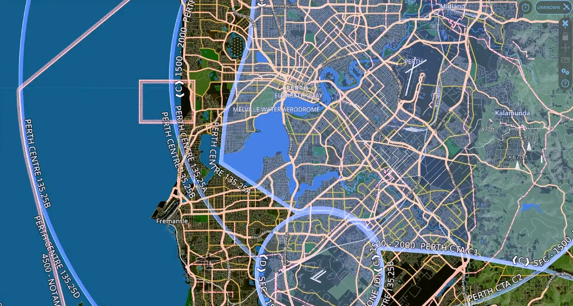
Perth-area land manager map
Where are you flying?
Hover over or tap an area to see who manages it and what they ask for, or search an address to see every land manager that applies at that spot. Councils are coloured by their position; the ones we are still confirming show their name only.
A council can’t stop you flying
The most common misconception in WA drone work is that a local council can stop you flying. It can't. Airspace is regulated exclusively by the Civil Aviation Safety Authority, and no local government has the power to override aviation law. What a council can control is the ground: whether you may take off from, land on, or run a commercial operation on land it manages.
That distinction matters on a shoot day. It means the question is rarely "am I allowed to fly here?" and almost always "whose land am I standing on, and who needs to approve the activity?" In practice there are four separate layers, and a WA production may need to satisfy several at once.
The four layers of permission
01
CASA: the airspace
Sets the rules that always apply: 120 m altitude limit, 30 m from people, no flying over populous areas, visual line of sight, and controlled-airspace restrictions near airports. Commercial work requires a RePL and operation under a ReOC. Nothing below this layer can grant you an exemption from it.
02
Local council: the ground you stand on
Councils manage parks, reserves, beaches and road verges. They can require permission to take off or land there, and most charge for a commercial filming permit. Policies vary widely between councils and are the least consistently published of the four layers.
03
DBCA: national parks, reserves and the Riverpark
Recreational flying in national parks and conservation reserves needs no departmental approval, but any commercial work requires a filming and photography permit. The Swan and Canning Riverpark needs its own permit from DBCA’s Rivers and Estuaries Branch, easy to miss when shooting the river through Perth.
04
Other land managers
Kings Park sits with the Botanic Gardens and Parks Authority, not a council. Ports, cemeteries, mine sites, rail corridors, private property and event venues each have their own controllers, and some rule on the air above them as well as the ground: Perth Zoo allows no drones within or above its grounds. If the land has an owner or operator, assume their permission is needed to launch from it.
Every flight sits under CASA's rules. What changes from job to job is who owns the ground you take off from, and you may need permission from more than one of the other three.
The practical shortcut
Because councils control ground access rather than airspace, launching from private property with the owner's consent removes the council land-access question entirely. It does not remove anything else: CASA rules still apply in full, and if you're conducting a commercial filming activity over council land, a permit may still be required for the activity regardless of where you took off. It's a useful option on tight locations, not a loophole.
Pre-shoot checklist
- □Confirm the airspace: controlled airspace, airport proximity, any temporary restrictions.
- □Identify who manages the land you’ll take off and land from, and get that permission in writing.
- □Check whether a commercial filming permit is required for the activity, separate from land access.
- □For national parks, reserves or the Swan and Canning Riverpark, apply to DBCA well ahead of the shoot.
- □Contact the relevant park district office before flying, so you don’t clash with prescribed burns or park operations.
- □Confirm crowd management. The 30 m rule is the constraint that most often changes a shot on the day.
- □Check weather, wind and light, and build in a contingency window.
Common questions
Do I need my own ReOC or RePL to hire a drone operator?
No. The certification belongs to the operator, not to the client. If you engage a certified drone operator for your shoot you do not need a ReOC, a RePL or your own drone insurance. You would only need your own ReOC and RePL if your own staff were flying your own drone for commercial purposes.
Can a local council stop me flying a drone in Western Australia?
No. Airspace is regulated exclusively by the Civil Aviation Safety Authority, and no local government has the power to override aviation law. What a council can control is the ground: whether you may take off from, land on, or run a commercial operation on land it manages.
Do I need a council permit to fly a drone in Perth?
It depends on whose land you launch from. The City of Perth requires a permit for launching and landing on council land, with the pilot's RePL, ten million dollars of public liability cover and at least five business days' notice. The Cities of Cockburn, Joondalup and Stirling and the Town of East Fremantle do not require council approval to fly. A commercial filming activity can still need a permit separately from the drone itself, as it does in Stirling.
Can you fly a drone in Kings Park?
Only commercially, and only with approval. The Botanic Gardens and Parks Authority does not permit hobby or recreational flying, because the park is treated as a populous area. Commercial drone work is by licensed operators in approved locations, assessed case by case, with permit fees and an acknowledgement of BGPA in the credits.
Can you fly a drone on Rottnest Island?
Recreational flying is prohibited. Commercial drone use is only possible through a Rottnest Island Authority filming permit, which carries a drone application fee, a risk management plan and documentation due at least thirty days before the shoot.
Can you fly a drone in a Western Australian national park?
National parks, conservation reserves and the Swan and Canning Riverpark are managed by the Department of Biodiversity, Conservation and Attractions, separately from council land. Approval is arranged through DBCA, and it is a separate application from any council permit.
How much notice do you need to arrange drone approvals for a shoot?
It depends entirely on the location. Councils commonly want five business days, Fremantle Ports ten working days, Rockingham up to twenty-one, and Rottnest Island at least thirty. A straightforward location with no permit requirement needs far less. Send Richard the location as early as you can and he will confirm the lead time it actually needs.
Do I need public liability insurance for a drone shoot?
Not personally. Richard carries his own cover as the operator. Some land managers require a certificate of currency to be lodged with the permit application: the City of Perth, Rockingham, Fremantle Ports and the Cemeteries Board set a ten million dollar minimum, and the City of Swan twenty million. That certificate comes from the operator, not from the client.
Can you film whales or dolphins with a drone in Western Australia?
Yes, within a hard limit. In WA a drone must stay at least 60 metres from whales, killer whales, dolphins, dugongs, seals and whale sharks. That separation is set by the Biodiversity Conservation Regulations 2018, with fines of up to five thousand dollars. It differs from other states, where 100 metres is common. The drone must also not disturb the animal's behaviour at any distance. In practice the shot comes from flying higher and cropping in post, not from flying closer.
What about filming near nesting birds or other wildlife?
The same disturbance rule applies, and it is the animal's response that matters rather than the distance alone. DBCA warns that effects on feeding and breeding behaviour are often not obvious from the air. On park land you are also asked to contact the relevant district office before each flight, so the drone does not conflict with aerial park management such as prescribed burning, and so you know about any seasonal breeding closures.
Verify before you fly. Regulations, council policies and permit fees change, and this guide is a starting point rather than legal advice. Always confirm current requirements with CASA, the relevant local government and DBCA before a shoot. If you spot something out of date here, let Richard know and he’ll correct it.
Official sources